
WEEK OF OCT 17-21
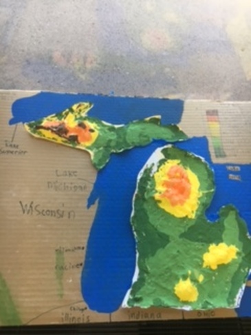
Students have continued their studies of special purpose maps including
land usage and climate maps of MI. This week, students wil create one last map, a population map of Michigan. We will end this week with a performance assessment of these 4 maps. Students must be able to discuss and explain the information included in each of the maps they have made. Maps will go home at the end of the week. For those who are able to come to Amerman at the end of the day, Friday Oct, 21st you could meet your child in the walkers line or loopers line to help transport maps home.
We will transition from this unit into a historical study of Michigan first people; Early American Indians. Student will understand The Annishinaabeg migration including The Ojibway, the Odawa, the Potawatomi, and the Huron. Students will explore how Michigan's geography helped allow for the formation of Three Fires Confederacy.
Students will form small groups and be assigned a tribe from Michigan. Students will research and present their information about their assigned group by creating a google slide presentation as well as creating "artifacts," diagrams, dioramas, and/or any other creative medium to help students understand more about Michigan's Early Native Americans way of life.
.